
Nome, Texas Population, History and Location
Fact-checked against official sources · Updated November 13, 2026
Nome is a small farming city in Jefferson and Liberty Counties. It sits about 68 miles east of downtown Houston by road. U.S. Highway 90 meets State Highway 326 and Farm Road 365. About 470 people live here, ringed by rice fields. It took its name from Alaska’s gold rush town after oil was found nearby. It is one of the Liberty County places in our list of Houston-area towns.
Nome, Texas at a Glance
| Fact | Detail |
|---|---|
| County | Jefferson and Liberty Counties |
| ZIP code | 77629 |
| Population (2020 Census) | 469 |
| Area | 1.24 square miles |
| Elevation | 43 feet |
| Coordinates | 30.038° N, 94.405° W |
| Distance from Houston | About 68 miles east of downtown by road |
| Main road | U.S. Highway 90 |
| Mayor | Kerry Abney, as of November 2026 |
| City Hall | 1586 2nd St · (409) 253-2391 |
| Police | (409) 835-8411 |
| 24-hour ER | Baptist Hospitals of Southeast Texas – Beaumont, Beaumont |
| School district | Hardin-Jefferson ISD |
| City website | nometexas.com |
Where Is Nome, Texas?
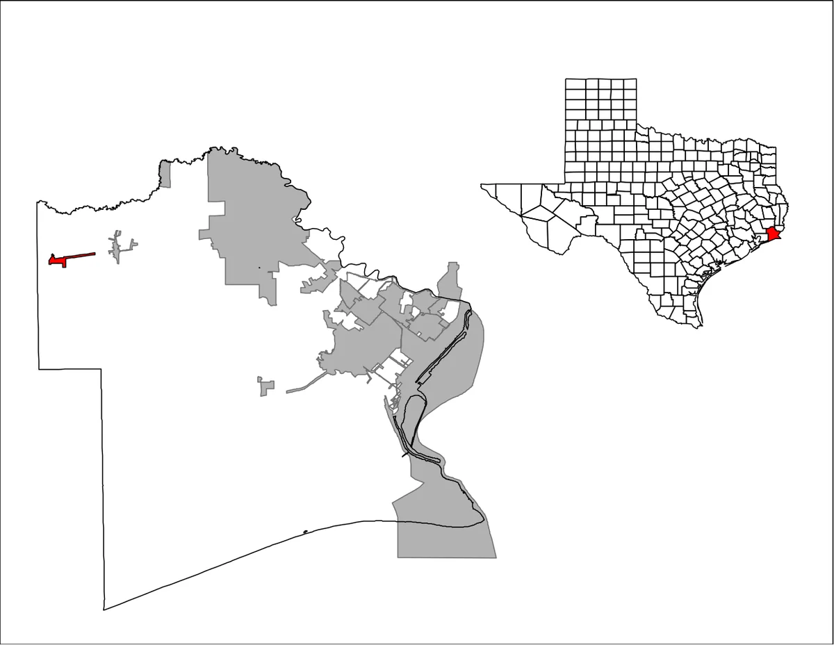
Nome sits on the western edge of Jefferson County, on the Liberty County line. The city straddles both counties, and the Texas Almanac lists it under Jefferson County. Downtown Houston stands about 68 miles west of Nome by road. Beaumont lies about 20 miles east, and Sour Lake about 7 miles north. The city covers 1.24 square miles of flat coastal plain.
Nome Population and Demographics
The 2020 Census counted 469 people in Nome. About 354 residents, or 76 percent, identified as White alone. About 59 residents, or 13 percent, identified as Black alone. About 41 residents, or 9 percent, identified as Hispanic or Latino. Six identified as American Indian and Alaska Native, and 17 as some other race. Another 33 identified as two or more races, and Nome counted 182 households.
History of Nome, Texas
The Texas State Historical Association says settlers first knew this place as Wolf Point. They also called it Tiger Point, Petry Woods or Carter’s Woods. The Texas and New Orleans Railroad built through in 1860 and 1861. The stop was called Congreve Station, for a New York financier of the line. A townsite by that name was platted and filed in 1887.
Residents began to call the junction Nome after nearby oil was found. The post office name changed to Nome in 1903. Nome grew as a center for rice farming. The Nome oilfield was found in 1936, and oil joined farming. Residents voted to incorporate the city in October 1971.
Nome City Government
A mayor and five council members govern Nome. Kerry Abney serves as mayor, as of November 2026. The council meets the first Tuesday of each month at 6 p.m. City Hall stands at 1586 2nd Street. Nome has no police department, and the Jefferson County Sheriff’s Office covers the city. The Sheriff’s Office answers at (409) 835-8411.
Living in Nome
- Water – The city runs its own water and sewer system. New customers apply at City Hall with a 150 dollar deposit. Bills can be paid online.
- Trash – The city site names no trash hauler or pickup days. Call City Hall for the current schedule.
- Flood risk – Nome sits on flat plain land 43 feet above sea level. Check any address on the FEMA flood map first.
- Emergency care – The nearest 24-hour ER is Baptist Hospitals of Southeast Texas, Beaumont. It stands at 3080 College St. Call (409) 212-5000 any time.
Things to Do In and Near Nome
- Nome City Park – The park hosts Christmas in the Park each December. The free event brings gumbo, cocoa, cookies, crafts and Santa.
- Big Thicket National Preserve, Lance Rosier Unit – A wild unit near Sour Lake. It lies about 16 miles northwest of Nome. It holds cypress swamps, palmetto flats and Little Pine Island Bayou.
For more ideas across the region, browse our Houston places map.
Schools in Nome, Texas
Hardin-Jefferson ISD serves the City of Nome. The district is based in Sour Lake, about 7 miles north. Its campuses are China Elementary, Sour Lake Elementary, Hardin-Jefferson Junior High and Hardin-Jefferson High. Check attendance zones before you move. Each campus rating is on TXschools.gov.


