
Baytown, Texas Population, History and Location
Fact-checked against official sources · Updated November 12, 2026
Baytown is a large industrial city in eastern Harris County. It lies about 28 miles east of downtown Houston by road. It sits where the San Jacinto River meets Galveston Bay, and oil built it. The Goose Creek oilfield made the area famous in 1916. The 2020 Census counted 83,701 people in Baytown, one of the largest cities near Houston. It is one of the Harris County places in our list of Houston-area towns.
Baytown, Texas at a Glance
| Fact | Detail |
|---|---|
| County | Harris and Chambers counties |
| ZIP codes | 77520–77523 |
| Population (2020 Census) | 83,701 |
| Area | 38.19 square miles (37.00 land, 1.18 water) |
| Elevation | 23 feet |
| Coordinates | 29.760° N, 94.968° W |
| Distance from Houston | About 28 miles east of downtown |
| Main road | Interstate 10 |
| Mayor | Charles Johnson, as of November 2026 |
| City Hall | 2401 Market St · (281) 422-8281 |
| Police | Baytown Police Department · (281) 422-8371 |
| 24-hour ER | Houston Methodist Baytown Hospital, Baytown |
| School district | Goose Creek CISD |
| City website | baytown.org |
Where Is Baytown, Texas?
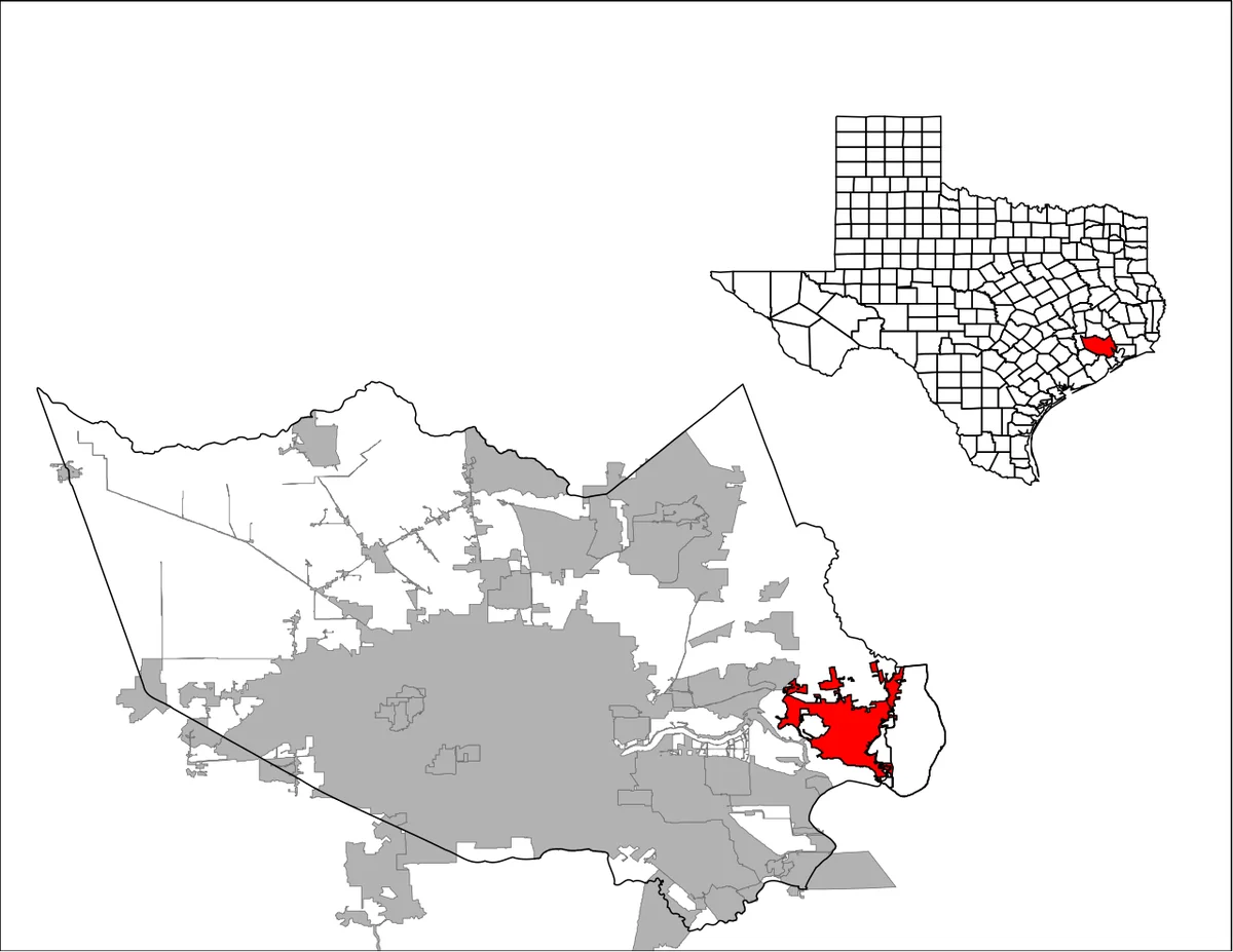
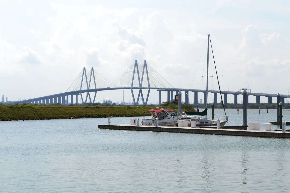
Baytown sits in eastern Harris County, at the mouth of the San Jacinto River. A small part of the city east of Cedar Bayou lies in Chambers County. La Porte lies about 8 miles southwest by road, across the Fred Hartman Bridge. Highlands sits northwest on Interstate 10. Mont Belvieu lies about 11 miles northeast on the same highway. The city covers 38.19 square miles of flat coastal plain, 23 feet above sea level.
Baytown Population and Demographics
The 2020 Census counted 83,701 people in Baytown. About 41,414 residents, or 49.5 percent, identified as Hispanic or Latino, of any race. Another 24,137 residents, or 28.8 percent, identified as White and not Hispanic. The census counted 15,833 Black residents, or 18.9 percent. It counted 1,865 Asian residents, or 2.2 percent. The census counted 61,186 residents of voting age in the city.
The 2020-2024 survey counted 30,964 households in Baytown. In the same survey, 78.6 percent of adults held a high school diploma. About 14.8 percent held a bachelor’s degree or higher. The median household income stood at 59,910 dollars in the same survey. About 18.2 percent of residents lived in poverty.
History of Baytown, Texas
A ferry has crossed the San Jacinto River here since 1822. Nathaniel Lynch set it up where the river meets Buffalo Bayou. The ferry still runs today as the Lynchburg Ferry. William Scott received a land grant here in 1824. He was one of Stephen F. Austin’s Old Three Hundred. Ashbel Smith bought a plantation named Evergreen on Tabbs Bay in 1847.
An oil strike beside Tabbs Bay in 1908 changed the area. The Goose Creek oilfield became famous in 1916. It was the first offshore drilling site in Texas. The towns of Pelly and Goose Creek grew near the oilfield in 1917 and 1918. Ross S. Sterling founded the Humble Oil and Refining Company in 1917. His firm bought 2,200 acres and called its site Baytown.
Humble laid out streets, built utilities, sold lots, and financed homes for workers. The firm ran the town so fully that Baytown never incorporated. Pelly annexed Baytown in December 1945. Pelly and Goose Creek voted to consolidate in early 1947. The citizens chose the name Baytown for the new city. The city of Baytown was established on January 24, 1948.
Baytown grew from 20,958 people in 1948 to 67,117 in 1990. Exxon still runs one of more than ten major petrochemical plants in the area. United States Steel opened the Texas Works near Baytown in 1970. The plant closed in July 1986. The Baytown-La Porte Tunnel opened in September 1953. The Fred Hartman Bridge replaced it in the mid 1990s.
Baytown City Government
A mayor and six council members govern Baytown. The city uses a council-manager system. Jason Reynolds serves as city manager, as of November 2026. Charles Johnson serves as mayor, as of November 2026. The council meets on the second and fourth Thursday of each month at 6:30 pm. A work session starts at 5:30 pm on the same days.
City Hall stands at 2401 Market Street, and the city office answers at (281) 422-8281. The Baytown Police Department works from 3200 North Main Street. Its non-emergency number is (281) 422-8371, and emergencies use 911. The city runs its own water and sewer system. New residents open an account online or at Utility Services. Utility Services stands at 315 West Texas Avenue, and it answers at (281) 420-6515.
Living in Baytown
- Water – New residents open an account online or at Utility Services. Deposits run 100 dollars for owners and 200 dollars for tenants. Call (281) 420-6515, or visit 315 W Texas Ave.
- Trash – Best Trash collects household trash twice a week under a city contract. Recycling runs once a week, and brush pickup runs weekly. Set bins out by 7 am on your collection day.
- Flood risk – Baytown sits on flat coastal plain, 23 feet above sea level. Check any address on the FEMA Flood Map Service Center before you buy or rent.
- Hurricanes – Baytown faces storm surge from Galveston Bay. Know your evacuation zone on the NWS hurricane evacuation map before storm season.
- Emergency care – The 24-hour ER is Houston Methodist Baytown Hospital, 4401 Garth Rd. Call (281) 420-8600 any time.
Things to Do In and Near Baytown
- Baytown Nature Center – This 500-acre peninsula sits east of Houston on Galveston Bay. It holds 7 miles of trail for birding, fishing, hiking and kayaking.
- San Jacinto Battleground – This historic site stands in La Porte. It marks the 1836 battle that won Texas independence. Check visiting details with the Texas Parks and Wildlife Department.
For more ideas across the region, browse our Houston places map.
Schools in Baytown, Texas
Goose Creek CISD serves Baytown. The district runs three traditional high schools in the city. The three high schools are Goose Creek Memorial, Robert E. Lee and Ross S. Sterling. Which campus a child attends depends on the home address. Check the district’s attendance zones before you move. Each campus’s state accountability rating is on TXschools.gov, the Texas Education Agency’s report-card site.
Housing in Baytown, Texas
The 2020 Census counted 32,894 housing units in Baytown. It counted 29,747 households in the same year. The 2020-2024 survey counted 30,964 households, and 52.3 percent of homes were owner occupied. The same survey put the median value of owner-occupied homes at 197,300 dollars. For current prices, check live listings and the Harris County Appraisal District.
How to Get to Baytown, Texas
From downtown Houston, take Interstate 10 east out of the city. Stay on I-10 past Channelview and Highlands to reach Baytown. The drive runs about 28 miles from downtown Houston. State Highway 146 runs north to south through Baytown. It crosses the Houston Ship Channel on the Fred Hartman Bridge. From La Porte, cross the bridge north on State Highway 146 to reach Baytown.
Nearby Towns
Baytown shares its corner of Harris County with La Porte, Highlands, Channelview and Deer Park. Mont Belvieu sits just east in Chambers County. La Porte lies southwest across the Ship Channel, and Highlands sits northwest on Interstate 10. Mont Belvieu sits northeast on Interstate 10, past Baytown. Channelview lies west on Interstate 10, and Deer Park lies southwest near the Ship Channel. You can find all of them in the Harris County section of our towns list.